
-Miranda
We saw a few deer and a strange wildflower I had not remembered seeing? turned out to be a "Heal-all". Trailhead was near: 47°58'51"N 91°58'59"W
-Joe
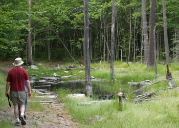
A wetland area we passed. Odie is in the water.

[ 1 comment ] ( 1 view )
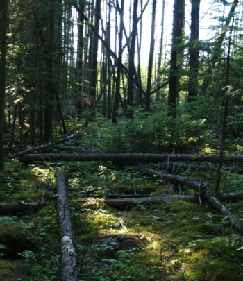
Joe and I drove up to the Boundary Waters to hike up Eagle Mountain, the highest point in Minnesota. It was a nice 3.5 mile hike. Busy weekend though, we passed quite a number of groups along the way. After the hike we decided that we would drive to his mother's house instead of going home. Along the way we saw a Ruffed Grouse and her babies, Ravens, and a cute baby coyote. The most excitement was when we almost hit a moose! Unfortunately we were unable to back the car up to try to get a picture.
-Miranda
We also updated our Fell in River, Broke Camera entry with some pictures off of the fixed camera below! Eagle Mountain is @ 47°53'51"N 90°33'39"W
-Joe
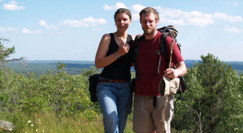
Joe and I on top of Eagle Mountain.
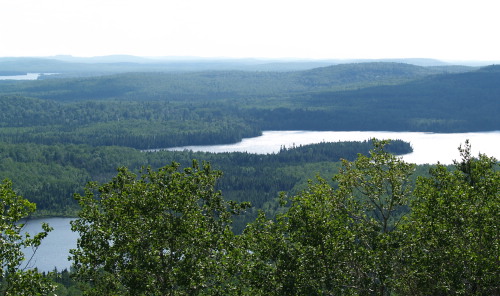
The view from top.
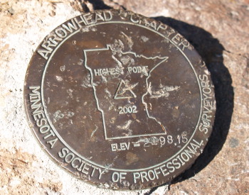
There was a plaque at the top as well as this marker.
Even after 7 years since the wind storm in the BWCAW, there is still evidence that it occurred.
[ add comment ]
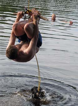
Friends of Joe's, Toan and Thang, came up from the Cities for the day, so we all went up to Soudan to check out some bat caves and go for a little hike. We didn't see any bats, but the three caves we checked out were neat. We were toasty after the hike so we went to an old mine pit nearby to swim. There's a nice cliff there that you can jump off of at many different hieghts. We all went off at least once.
-Miranda
Afterwords, Toan, Thang, Tim and I went out into the woods behind the house and had a Campfire Dinner.
P.S.
Caves Near: 47°49'18"N 92°13'56"W
Nice Cliff Pit: 47°48'35"N 92°15'52"W
-Joe
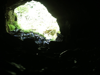
A cave we explored.
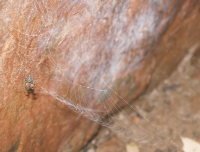
A spider we found near the end of a cave.
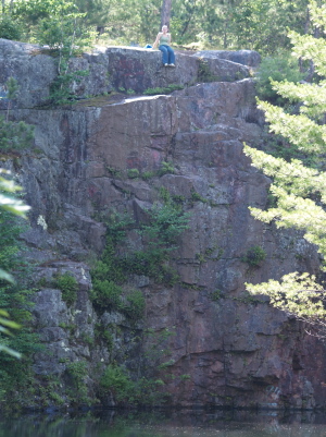
The 'cliff' we jumped off of. The ledge is almost halfway up on the left side of the photo.
[ 3 comments ] ( 13 views )
My Mother, Miranda, and I went for a quick camping trip to a fun little campsite up a river across Island Lake. Odie behaved well on our travel across the lake. Real nice Pine needle floored campsite. There was a rope swing nearby also. Highly recommend unmarked campsite @ GPS 47°1'36"N 92°4'56"W.
-Joe
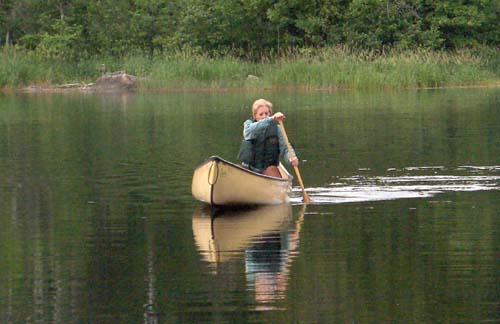
My Mum out for a little paddle
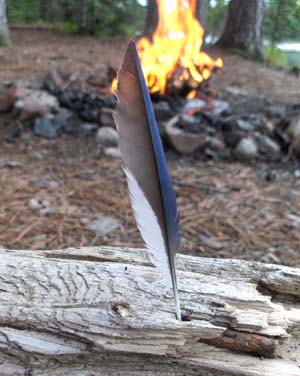
Miranda's artsy Blue Jay feather composition. Rope Swing near campsite.
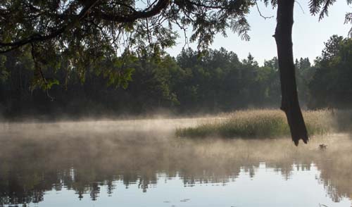
Morning mist flowing down river
[ 5 comments ] ( 11 views )
Erin and Jon took us for a quick hike up at Jay Cooke State Park. We walked along the sharp rocks of the St Louis River. There was speculation that it may be possible to cross the river along a stretch of large rocks in the river. I took it upon myself to try, and learned a good lesson
. There are rocks that you can jump onto, which then you cannot jump back. After making about a dozen or so such jumps, and then getting almost to the otherside, I found there was a 10' gap, and it was rushing water, too deep to touch. So after feeling trapped for a good 30 minutes and running around trying to find alternative routes, I stuck my cell phone and wallet in my hat, and threw the camera to shore... Then went swimming!.. So it's good fun to jump rocks, but make sure you can jump back . Erin also managed to fall in on the way back -Joe
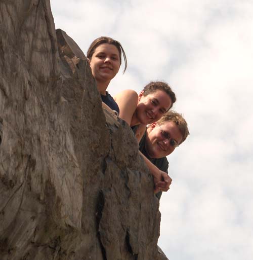
Miranda, Erin, and Jon hanging over the water.
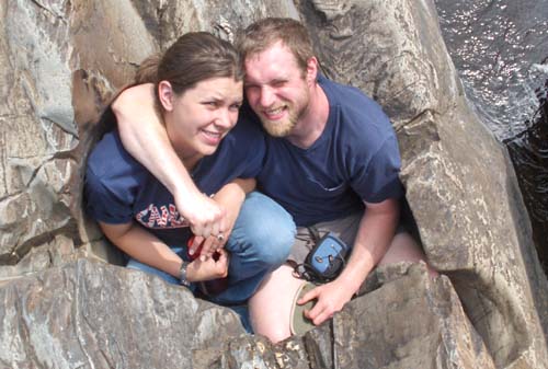
Miranda and Joe stuck in a big swirl-hole.
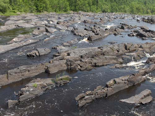
The large rock field joe crossed.
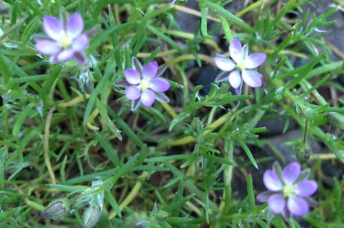
Pretty little purple flowers.
[ add comment ]
Back Next
 Calendar